The results of this petition will be delivered to Governor Phil Murphy, the DEP Commissioner, Legislators and local Municipalities.
Important: In order that we can direct the petition to the right representatives, please include your town name.
6325 have signed our petition so far! Sign now to help us get our goal of 8500 signatures!
Introduction
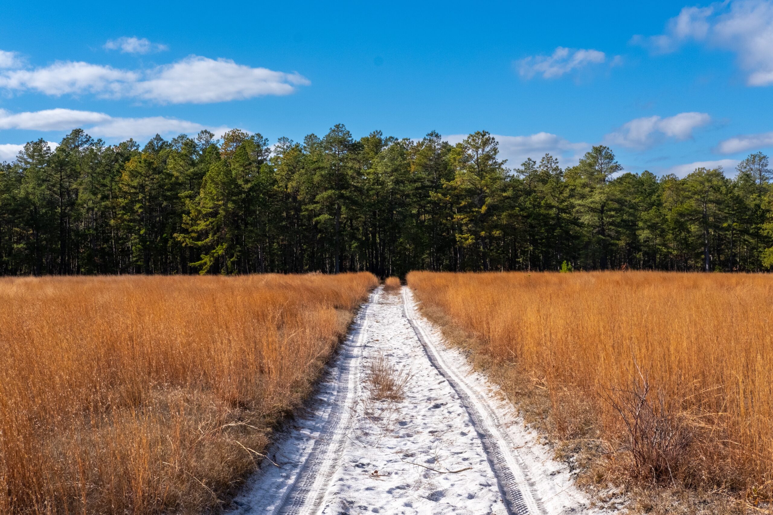
Wharton State Forest is a gem in South Jersey. It consists of 125,000 acres of forest, rivers, and sugar sand roads. It provides endless recreation opportunities for hundreds of thousands of NJ residents. For such a densely populated state, its size is almost incomprehensible. You would never know it today, but in the 19th century, it was home to many small towns and industries. The state purchased the bulk of the forest in the 1950s and continued to add to it over time. While the industry and towns have faded, the vast network of roads continues to provide recreational access to millions of people. Hikers, boaters, fishermen, bikers, hunters, birdwatchers, explorers, and stargazers, have used these roads to gain access to their favorite form of recreation. All of these roads are documented in the USGS Topographical maps and were adopted as the baseline of roads by the Pinelands Commission in 2017. (1)Why Does the Public Need So Many Roads in Wharton State Forest?
You can find an analogy for this in the leaves of a tree or our body’s circulatory system. Asking why you need so many roads is akin to asking why do you need your capillaries when you have your arteries? Or why does a tree need so many branches when it has its trunk? The answers to all these questions are similar: the capillaries deliver blood to our bodies, the smallest branches on trees deliver water to the leaves of the trees, and the smallest roads deliver people to their recreational activities. Just like the leaves of a tree would die without their branches, recreation opportunities would die without these smaller roads. Every user of Wharton State Forest, regardless of their activity, is a motorized user.Department of Environmental Protection’s Action
In 2015 the DEP decided, without warning, to close over 250 miles of roads within Wharton State Forest. The community outrage against this action sparked a grassroots effort (2) to educate the DEP on the significant negative consequences to outdoor recreation resulting from the closures. Numerous local municipalities passed resolutions (3) condemning the road closures. Ultimately, the DEP relented, reopened the roads, and apologized for the action. (4)In 2022, the DEP began a new effort to plan to close roads and implement a permit system in Wharton State Forest. The DEP collected surveys from users of the forest and the message was clear: Of the 1,610 surveys submitted, by a nearly 3 to 1 margin, users asked for the same access they have today. “Scenic driving” and “day to day travel” were mentioned over 1,000 times.
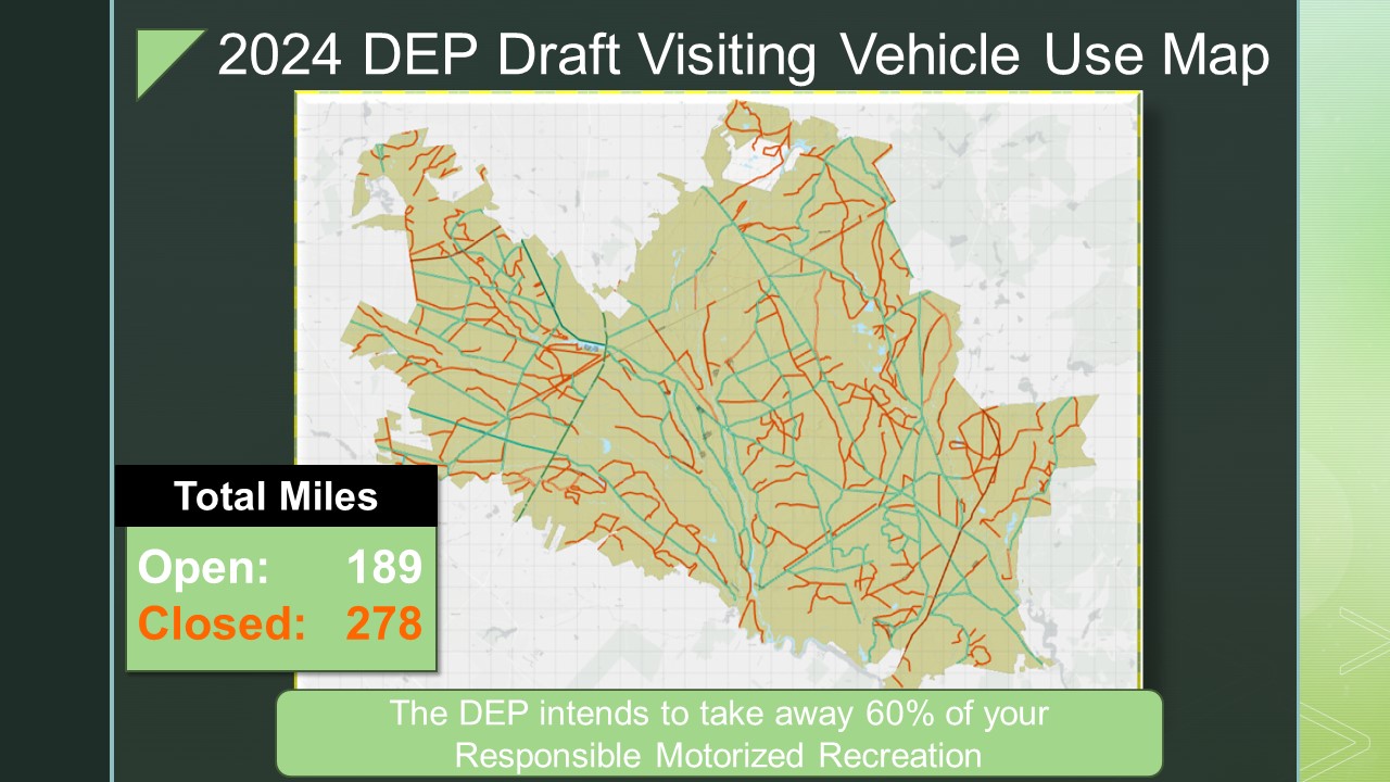
The DEP then revealed a new map at an Open House on January 24th with over 500 people in attendance. The overwhelming majority of individuals attending were coming to voice their concerns about these road closures. The new map closed 300 miles of roads (5) and was essentially identical (6) to the 2015 map. Not a single input from the 1,610 survey participants appears to have been taken into account.
Deceptive Acts, Trust is Destroyed
The DEP has claimed many of the roads they are closing were not legal roads or were already not accessible. This simply is not true. According to the DEP’s own regulations, users can drive on “established public roads”. These roads are clearly identified on the USGS Topographical maps that were codified by the Pinelands Commission and countless other maps. Further, in a funding grant request that was obtained via an Open Public Records Request, the DEP states they were seeking funding for the 600 miles of roads within Wharton State Forest. (7) Were they not truthful about these roads then when they were looking for funding to repair them? Or are they not truthful now when they are trying to close 300 miles of them and are saying they are invalid? These roads are not “trails”, they are not “routes”, they are “roads”. Finally, these roads are nearly inconsequential to the ecosystem relative to their size. At 500 miles, the surface area all the roads in Wharton equate to 0.39% of the area of the forest.Now the DEP is asking for feedback again on the new map. Why should the citizens of NJ trust the DEP when they didn’t consider the 1,610 voices the first time around and they continue to be untruthful about the legal roads that exist today? The DEP did not take even one step in compromise towards the public in their recent map. Why should the public believe they will take any additional feedback into account?
There are Solutions
The answers to the issues within the forest are not road closures, which will not curb illegal activity, but only destroy recreation opportunities for law abiding citizens. The solutions are:- Increased enforcement- Give our Park Police the resources they need to enforce the laws that already exist.
- Protection Projects – Leverage volunteer labor and funding for resource projection projects that will protect sensitives areas, but not close roads used to access them.
- Education – Embark on an education campaign to educate the public about our natural resources, why it is important to respect them, and educate them about how to access the forest safely.
Our Ask
Given the shattered public trust, there is no path forward on this current plan. The DEP must scrap this 2024 map and adopt the topographical maps that were codified by the Pinelands Commission. The DEP should re-reread the feedback it has already received and, instead of asking the public to justify which roads are needed, the DEP needs to justify to the public each road they believe needs to be closed, individually. We the citizens of your state, districts and municipalities are asking you to take any action within your power to force the DEP to scrap the 2024 map and start over.Supporting Material Referenced in Petition:
(1) Pinelands Commission 2017 USGS Topo Map Resolution
(3) Municipal Resolutions against the MAP